
A detailed subsurface analysis that helped stabilise a slipping iron ore mine face in South Africa, improving safety and operational confidence.
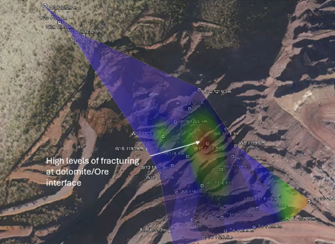
At a large iron ore mine in South Africa, the client faced ongoing safety shutdowns due to an unstable mine slope that was slipping and moving unpredictably. Traditional methods weren’t giving clear insight into the geological structure, fault boundaries, or the role of groundwater in the slope movement. Using GeoVue’s electro-seismic technology, the team mapped the subsurface in detail, revealing key geological boundaries and identifying natural water sources contributing to instability. This improved understanding allowed the mine owner to design a targeted dewatering program and make informed engineering decisions that reduced risk and improved operational continuity. The result was a clearer picture of the mine’s geology and hydrology, empowering the client to address the slope stability issues with confidence and precision.
If you’re a government body or large organisation planning a major project and feel the mobile app setup may not meet your scale requirements, we’re ready to support you. Contact us to discuss our advanced, large-scale survey systems designed specifically for complex and high-capacity operations.
Info@Geovue.net